
توضیحات
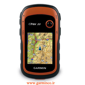
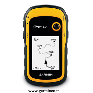
معرفی جی پی اس گارمین Etrex 20
جي پی اس Etrex 20 يکي از مناسب ترین (از لحاظ قیمت) و قابل اعتمادترين جي پي اس هاي دستي جهان است.که قابلت دریافت همزمان ماهواره های جی پی اس امریکا و گلوناس روسیه را دارا میباشد طراحي مجدد براساس ارگونومي، رابط کاربر آسان، ژئوکاشه بدون کاغذ و قابليت هاي بسط يافته نقشه، توانايي هاي اضافه شده و بهبود جدي اين جي پي اس دستي خارق العاده، آن را بهتر از قبل ساخته است.این جی پی اس دستی گارمین جایگزین جی پی اس دستی گارمین etrex vista cx میباشد
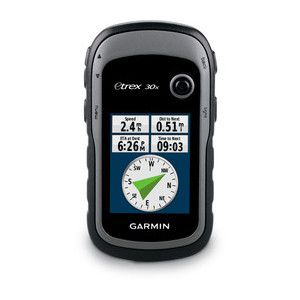
مشخصات جی پی اس گارمین Etrex 20
- مجهز به صفحه نمایش رنگی در ابعاد ۲.۲اینچ
- مجهز به گیرنده با حساسیت بالا
- قابلیت اتصال همزمان به ماهواره های GPSو GLONASS
- قابلیت ذخیره سازی ۲۰۰۰نقطه و ۲۰۰ مسیر
- قابلیت ذخیره سازی ۲۰۰ خط سیر
- دارای ۱.۷ گیگا بایت حافظه داخلی
- قابلیت افزودن کارت حافظه خارجی به صورت Micro SD
- قابلیت محاسبه مساحت
- مجهز به نقشه پایه
- قابلیت اضافه کردن و نصب نقشه
- امکان ارسال اطلاعات به صورت wireless به دستگاه های مشابه
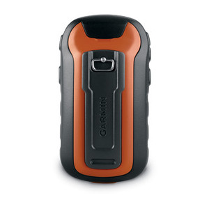
- تغذیه از دو باطری AA
- عمر باطری به مدت ۲۵ ساعت
- مجهز به منوی فارسی
- مجهز به خروجی USB

نقد و بررسیها
هنوز بررسیای ثبت نشده است.